Dragon's Back to Chai Wan
- SamJackWebster
- Jun 4, 2020
- 3 min read
Updated: Sep 7, 2021
This trail is a HARDENED version of Dragon's Back. It has the same starting point as the Dragon's Back trail but instead of taking you down to Big Wave Bay it passes through dense bamboo forest until you reach the peak of Mount Collinson. You'll then gradually descend down a dried-up waterfall and end up in Chai Wan. The difficultly of this hike all depends on how overgrown the vegetation is. When overgrown, the route becomes arduous, sweaty and requires perseverance. A great physical and mental challenge.
Hike Location: Hong Kong Island, Shek O
Hike Difficulty: Moderate (5/10)
Hike Length: 5 Hours
High Distance: 7km
Elevation Gain: ~300m
To get to the trailhead you need to head towards Shek O Country Park on Hong Kong Island. The nearest MTR station is Chai Wan. Instructions for the taxi driver: "Shek O Road" or ask for the Dragon's Back hike; most will know where it starts. You can also refer to my starting point on the map attached at the bottom of the blog. You're aiming to get out of the taxi when you see the toilet blocks on the side road as in photo 2. Follow the steps up and stick to the route signposted as 'Dragon's Back'.

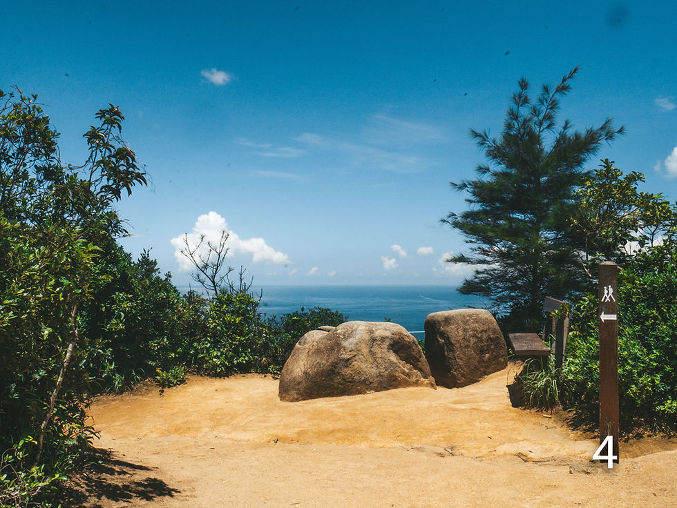
When you get to the intersection in photo 4 you need to turn left. You can take a quick detour by turning right, where you'll find scenic viewpoints and great rocks to climb. Avoid spending too much time here though, as you'll probably want to make it out of the bamboo jungle and Catholic cemetery before it goes completely dark.
Keep along the ridge line and take in the stunning seascapes. Soon all you'll see is bamboo.
After approx. 1 hour you will reach the dirt-path intersection in photo 12. Here you need to go straight forward, past the warning sign (always a good sign, but do so at your own risk). Say goodbye to the clear cut path and hello to sub-tropical jungle. From here on it gets pretty shady with occasional beams of sunlight filtering through the dense trees.
Although much narrower, the path should be visible all the way up to the trig point at the peak of Mount Collinson (photo 18). Keep an eye out for ribbons (white, red, neon-green and orange). Some have clearly been there for a while so I recently attached some white ribbons at points where I thought the path looked a little uncertain - so if in doubt, look for the newer white ones. This part should take you anywhere between 1 and 2 hours, depending on how overgrown the path is, which depends on the season.
Once you reach the trig point you'll notice there are three routes to choose from for your journey down. TAKE THE MIDDLE ROUTE. Although it's the most overgrown it'll will take you to a riverbed that leads you down a dried-up waterfall. After entering the thick vegetation you will shortly come out at an opening that overlooks Chai Wan (photo 19). From here on you simply follow the water down hill. This bit requires a small amount of scrambling, but nothing too challenging. The arrows on photo 23 give an aerial view of this waterfall route to Chai Wan.
After another 30 minutes to 1 hour you'll hit a road. Photo 24 shows the point of leaving the stream. Continue right (North-East) along the road until you reach the sign post in photo 26.
At the sign take a left through the open trees for one final off-piste section. Here you'll find a dirt path lined with metal poles. Follow it down to the maintenance access steps. Turn left at the bottom and then continue down the path until you come out into a huge cemetery.
Finding your way out of the cemetery is just as challenging as the jungle walk. We managed to reach the bottom and then hopped a small fence to get to the road outside. This is where the adventurous version of Dragon's Back finishes. Enjoy and try not to get lost.
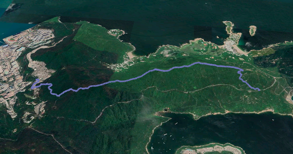
See the route I took on the MAP below (green dot is the starting point) and download the KML file to see the route in Google Earth 3D. Watch my KML tutorials for downloading the map on both laptop and mobile.
Below is a screenshot from the Google Earth KML file.


Comments